


Idiomas
Páginas
Jurídico


2019
Arqueología y Prehistoria del
Interior Peninsular
08

ARPI 08
Publicación: 2019 ISSN: 2341-2496 Dirección: Primitiva Bueno Ramírez (UAH) Subdirección: Rosa Barroso (UAH) Consejo editorial: Manuel Alcaraz (Universidad de Alca-lá); José Mª Barco (Universidad de Alcalá); Cristina de Juana (Universidad de Alcalá); Mª Ángeles Lancharro (Universidad de Alcalá); Adara López (Universidad de Al-calá); Estíbaliz Polo (Universidad de Alcalá); Antonio Vázquez (Universidad de Alcalá); Piedad Villanueva (Universidad de Alcalá). Comité Asesor: Rodrigo de Balbín (Prehistoria-UAH); Margarita Vallejo (Historia Antigua- UAH); Lauro Olmo (Arqueología- UAH); Leonor Rocha (Arqueología – Uni-versidade de Évora); Enrique Baquedano (MAR); Luc La-porte (Laboratoire d'Anthropologie, Université de Ren-nes); Laure Salanova (CNRS). Edición: Área de Prehistoria (UAH) Foto portada: Ricardo L. Barbas
SUMARIO Editorial 04– 24 El dolmen de La Pinilla en Alcolea del Pinar (Guadalajara) y el conjunto megalítico del sistema Ibérico central. Redescubriendo la Historia. Barbas Nieto, Ricardo L. 25– 30 Reuse of ancient megalithics monuments during Metal Ages: the dolmen of Serrinha (Monforte, Portugal). Rocha, Leonor y Morgado, Paula 31-50 Una perspectiva paleoambiental de la transición Bronce Medio-Final al Hierro en la Meseta Norte a través de sus contextos habitacionales: el castro de la Peña del Moro (Navas de Oro, Segovia) Martín Vela, Raúl; Pérez Díaz, Sebastián y López Sáez, José Antonio 51-66. La evolución de las investigaciones prehistóricas en el Departamento de Ille-et-Vilaine (Bretaña, Francia) Illana López, Sofía 67-85 Los infantes y la muerte en la antigua Celtiberia Moreno Ojeda, Lucía 86-105 Evidencias arqueológicas de la peste Justinianea en Hispania Benavides Barco, María 55-55 106-151 VRBS, PRAETORIUM, SVBVRBIA. Centro de poder en la civitas regia toletana y su territorio en época visigoda. Barroso Cabrera, Rafael; Carrobles Santos , Jesús; Morín de Pablos , Jorge y Sánchez Ramos, Isabel María.
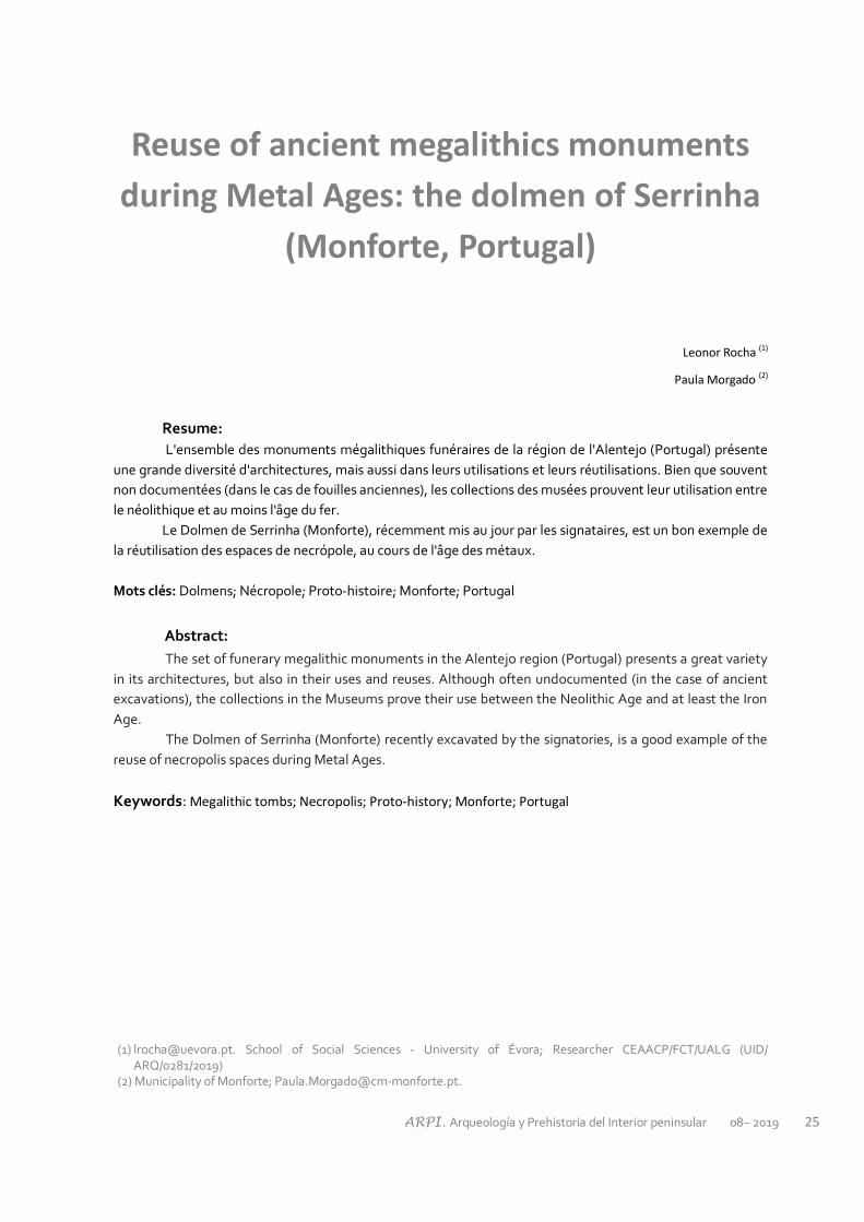
ARPI. Arqueología y Prehistoria del Interior peninsular 08– 2019 25
Reuse of ancient megalithics monuments
during Metal Ages: the dolmen of Serrinha
(Monforte, Portugal)
Leonor Rocha (1)
Paula Morgado (2)
Resume:
L'ensemble des monuments mégalithiques funéraires de la région de l'Alentejo (Portugal) présente
une grande diversité d'architectures, mais aussi dans leurs utilisations et leurs réutilisations. Bien que souvent
non documentées (dans le cas de fouilles anciennes), les collections des musées prouvent leur utilisation entre
le néolithique et au moins l'âge du fer.
Le Dolmen de Serrinha (Monforte), récemment mis au jour par les signataires, est un bon exemple de
la réutilisation des espaces de necrópole, au cours de l'âge des métaux.
Mots clés: Dolmens; Nécropole; Proto-histoire; Monforte; Portugal
Abstract:
The set of funerary megalithic monuments in the Alentejo region (Portugal) presents a great variety
in its architectures, but also in their uses and reuses. Although often undocumented (in the case of ancient
excavations), the collections in the Museums prove their use between the Neolithic Age and at least the Iron
Age.
The Dolmen of Serrinha (Monforte) recently excavated by the signatories, is a good example of the
reuse of necropolis spaces during Metal Ages.
Keywords: Megalithic tombs; Necropolis; Proto-history; Monforte; Portugal
(1) [email protected]. School of Social Sciences - University of Évora; Researcher CEAACP/FCT/UALG (UID/ARQ/0281/2019)
(2) Municipality of Monforte; [email protected].

ARPI. Arqueología y Prehistoria del Interior peninsular 08– 2019 26
1. Introduction
The Dolmen of Serrinha is referred to in the Portu-
guese archaeological literature since the mid-
twentieth century (Leisner e Leisner, 1959), as one
of the large megalithic monuments of the Munici-
pality of Monforte. It is classified as a site of Public
Interest (Portaria 740 – BC/2012, de 24 de Dezem-
bro de 2012), even though only half of its chamber
is preserved and its corridor shows significant signs
of damage. This dolmen is integrated today into
the monuments itinerary of the Municipality of
Monforte.
In terms of its location, the monument was erected
in an unusual place, when considering the pattern
of the megalithism of the Alentejo. That is because
it is located at a very low altitude, close to the
point where the Almuro watercourse joins the
Grande watercourse, in a very flat and floodable
area when there are high levels of rainfall.
In topographic terms, the Municipality of Monforte
is characterised by gentle slopes in the North,
whereas the South/Southeast is characterised by a
more irregular relief, due to the presence of large
granite outcrops associated to the ancient bed-
rock, now almost flat having undergone a long pe-
riod of erosion. The steeper slopes are located
close to the streams of Almuro, Ribeira Grande,
Samarra, Carrascal, Almadafe, Divor and Têra.
The highest altitudes are registered in the South,
close to Stº Aleixo (402m) and in the outcrops
East/North of Vaiamonte (393m). The valleys are
open, with relatively gentle slopes, and are easily
accessible.
From a geomorphological perspective, this area is
part of a relatively diverse region, between the S.
Mamede Mountain (Serra de S. Mamede) to the
North and the Ossa Mountain (Serra d’Ossa) to the
South. Monforte is also part of the Monforte –
Alter do Chão aquifer system, comprising an area
of around 100 km2, presenting a rough NW-SW
orientation. From a geological point of view, it is a
very diverse region, characterised by a predomi-
nance of igneous rocks – orthogneisses and gran-
ites (Gonçalves, 1975).
Figure 1 – Location of the Dolmen of Serrinha (Monforte,
Portugal)
In administrative terms, the monument is located
in the Municipality of Monforte, Parish of Mon-
forte, Portuguese Military Map (Carta Militar de
Portugal) 1: 25, Sheet 398, with the following coor-
dinates: Latitude: 254 918.539 / Longitude: 229
803.061 / Altitude: 207m (Figure 1).
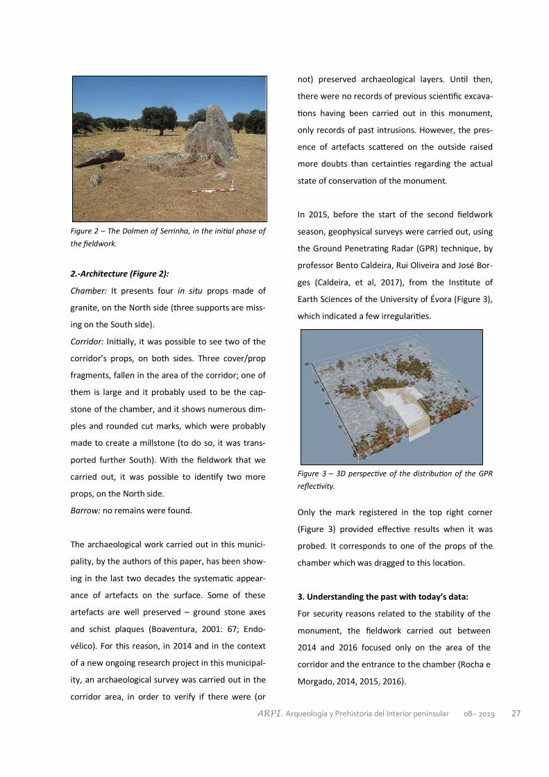
ARPI. Arqueología y Prehistoria del Interior peninsular 08– 2019 27
Figure 2 – The Dolmen of Serrinha, in the initial phase of
the fieldwork.
2.-Architecture (Figure 2):
Chamber: It presents four in situ props made of
granite, on the North side (three supports are miss-
ing on the South side).
Corridor: Initially, it was possible to see two of the
corridor’s props, on both sides. Three cover/prop
fragments, fallen in the area of the corridor; one of
them is large and it probably used to be the cap-
stone of the chamber, and it shows numerous dim-
ples and rounded cut marks, which were probably
made to create a millstone (to do so, it was trans-
ported further South). With the fieldwork that we
carried out, it was possible to identify two more
props, on the North side.
Barrow: no remains were found.
The archaeological work carried out in this munici-
pality, by the authors of this paper, has been show-
ing in the last two decades the systematic appear-
ance of artefacts on the surface. Some of these
artefacts are well preserved – ground stone axes
and schist plaques (Boaventura, 2001: 67; Endo-
vélico). For this reason, in 2014 and in the context
of a new ongoing research project in this municipal-
ity, an archaeological survey was carried out in the
corridor area, in order to verify if there were (or
not) preserved archaeological layers. Until then,
there were no records of previous scientific excava-
tions having been carried out in this monument,
only records of past intrusions. However, the pres-
ence of artefacts scattered on the outside raised
more doubts than certainties regarding the actual
state of conservation of the monument.
In 2015, before the start of the second fieldwork
season, geophysical surveys were carried out, using
the Ground Penetrating Radar (GPR) technique, by
professor Bento Caldeira, Rui Oliveira and José Bor-
ges (Caldeira, et al, 2017), from the Institute of
Earth Sciences of the University of Évora (Figure 3),
which indicated a few irregularities.
Figure 3 – 3D perspective of the distribution of the GPR
reflectivity.
Only the mark registered in the top right corner
(Figure 3) provided effective results when it was
probed. It corresponds to one of the props of the
chamber which was dragged to this location.
3. Understanding the past with today’s data:
For security reasons related to the stability of the
monument, the fieldwork carried out between
2014 and 2016 focused only on the area of the
corridor and the entrance to the chamber (Rocha e
Morgado, 2014, 2015, 2016).

ARPI. Arqueología y Prehistoria del Interior peninsular 08– 2019 28
The removal of the capstone of the chamber
(2014), which had fallen and was then found in the
transition area between the chamber and the corri-
dor, immediately exposed an archaeological layer
with small bone remains, mixed with rubbish from
more recent dates (wires, glasses, buttons, metal
bottle caps, etc.) and handmade and wheelthrown
pottery, mixed with the gravel that had been
placed inside the monument’s chamber, at an un-
known moment. In general terms, the excavation
of the superficial levels revealed a significant dis-
ruption, given the mix of contemporary materials,
with bones out of context and prehistoric remains.
The lower levels revealed the most interesting re-
sults for understanding the different phases of use
and alterations that this monument underwent. At
this moment, and considering the existing archaeo-
logical data (stratigraphy and artefacts) and the
absence of radiocarbon dating (which we hope to
carry out soon), we can consider the following
phases of occupation/use/reuse/destruction of this
monument:
• Phase I – Construction and first occupation: Late
Neolithic
The excavation up until the base of the corridor’s
props allowed us to determine that these were
placed on the layer of thick sands (shingle) created
by the river, where the monument was also erect-
ed. The props were surrounded by medium/large
stones to guaranty their stability.
The remains of the funerary occupations related to
this First Phase had been moved around by later
occupations, hence only small deposits of human
bones and artefacts were found, close to the corri-
dor’s props. In terms of chronology, this phase is
likely to be dated to the first half of the 4th millen-
nium BC, considering the artefacts that were found
(concave-base arrowheads, slender blades, geo-
metric microliths, pottery, beads and schist
plaques).
Figure 4 – Phase I: slender blades.
• Phase II – The second occupation: Chalcolithic
The second phase of occupation is probably dated
to the second half of the 3rd millennium BC, during
the Chalcolithic. The modification at the entrance
of the corridor – the addition of one more prop,
which reduced the original width – is possibly dated
to this phase.
In terms of artefacts, no significant changes were
registered, except for an increase in the diversity of
arrowheads, an increase in the width of the blades,
the presence of pins made of bone and, of course,
the presence of large flint spearheads.
Figure 5 – Phase II: large flint spearheads

ARPI. Arqueología y Prehistoria del Interior peninsular 08– 2019 29
• Phase III – The third occupation: Bronze Age
The third phase of use/reuse of the dolmen of Ser-
rinha occurred during the Bronze Age (2nd millen-
nium BC). To this phase, we can probably associate
some recorded architectural modifications, namely
the introduction of two props made of greywacke
in the separation chamber/corridor, the construc-
tion of a hall paved with cobblestones and the pres-
ence of a small box made of schist, located inside
the chamber.
To this phase are associated also the carenated
vases and the small ceramic rectangular boxes, as
well as the possible use of chipped stone artefacts
from earlier phases, which, because they were kept
in use for a long period of time, do not allow us to
produce a more precise chronology.
Figure 6 – Phase III: small box made of schist, locat-
ed inside the chamber.
• Phase IV – Iron Age reuse
At an indefinite moment during the first Iron Age
(sixth-fourth centuries BC) another reuse of the
monument was registered. This probably corre-
sponded to only one burial, in the corridor, above
one of the props on the South side. This prop was
facing inward, which led to the collapse of the ex-
ternal abutments. The subsequent disturbances to
the site prevent us from producing an objective
characterisation of this phase, which is represented
by one vitreous bead, and a few shards of
wheelthrown pottery.
Figure 7 – Phase IV: vitreous bead inside the corridor.
• Phase V – Disturbance/destruction episode(s)
The final chapters of the history of this monument
are even harder to situate in time. In fact, the de-
struction of the architecture of the monument
(removal and/our cutting of props and covers) is
likely to have occurred at a moment before the
second half of the nineteenth century, when dyna-
mite appeared, considering that the props were
broken using the traditional wooden wedges. Fur-
thermore, the capstone of the chamber shows evi-
dence of an attempt to break it to make a mill-
stone.
Figure 8 – Phase IV: the capstone of the chamber shows
evidence of an attempt to break it to make a millstone.
ARPI. Arqueología y Prehistoria del Interior peninsular 08– 2019 30
The props removed from the chamber, the ones
amputated in the corridor and the covers are thus
likely to have been used as raw-materials for other
constructions. These constructions, as we men-
tioned above, could have included elements of wa-
ter mills (which existed in the Almuro stream),
walls, fences or even for the road that was con-
structed nearby.
The artefacts found represent very distinct chronol-
ogies, from Medieval/Modern times (common or
glazed wheelthrown ceramics, coins) to contempo-
rary times (faience, wires, glasses, buttons, metal
bottle caps, tins, etc.), which were found deposited
mainly in the two upper layers.
Considering the type of architecture and the arte-
facts collected, the Dolmen of Serrinha fits into the
typical typologies of the second half of the 4th mil-
lennium BC for this region, characterised here by
monuments presenting large chambers, and wide,
more or less long corridors. Other examples include
the dolmens of Capela de S. Dionísio (Pavia), Cabe-
ceira 1 (Brotas), (Anta) 1 da Ordem (Avis) and Tapa-
dão (Crato). Besides having been used for a long
time (until the end of the 3rd millennium BC), their
size has also raised interest and curiosity across
different times (Rocha, 2015, 2016). And that con-
stitutes the reason why these monuments wit-
nessed successive moments of reuse, intrusion and
destruction, which mixed up and disturbed the
original occupations, hence raising more doubts
than certainties regarding their chronologies.
BIBLIOGRAFIA
BOAVENTURA, R. 2001: O sítio calcolítico do
Pombal (Monforte): Uma recuperação possível de
velhos e novos dados. Lisboa: IPA.
CALDEIRA, B; OLIVEIRA, R; BORGES, J. 2017: Anta
da Serrinha. Relatório Geofísico. Universidade de
Évora/ ICT.
GONÇALVES, F. 1975: Carta geológica de Portugal.
Sousel: Folha 32-D: 1:50.000: Notícia explicativa.
Lisboa: Serviços Geológicos de Portugal.
LEISNER, G. e V. 1959: Die Megalithgraber der
Iberischen Halbinsel: Der Westen. Berlin: Walter de
Gruyter. II: 2.
ROCHA, L. 2015: The Funerary Megalithic of
Herdade das Murteiras (Évora, Portugal): the (re)
use of the spaces. Death as Archaeology of Transi-
tion: Thoughts and Materials. Edited by Leonor
Rocha, Primitiva Bueno-Ramirez and Gertrudes
Branco. BAR International Series 2708, 221-230.
ROCHA, L. 2016: Percorrendo antigos [e recentes]
trilhos do Megalitismo Alentejano. Terra e Água.
Escolher Sementes, invocar a Deusa. Estudos em
Homenagem a Victor S. Gonçalves. SOUSA, A.C;
CARVALHO, A; VIEGAS, C. (eds). Estudos &
Memórias. 8. Lisboa, 167-177
ROCHA, L; MORGADO, P. 2016: Anta da Serrinha
(Monforte). Relatório Técnico-científico da 2ª
Campanha/2015. Acessível nos Arquivos da DGPC.
Lisboa, Portugal. 30pp.
ROCHA, L; MORGADO, P. 2015: Anta da Serrinha
(Monforte). Relatório Técnico-científico da 2ª
Campanha/2015. Acessível nos Arquivos da DGPC.
Lisboa, Portugal. 30pp.
ROCHA, L; MORGADO, P. 2014: Anta da Serrinha
(Monforte). Relatório de Progresso/2014. PNTA –
Levantamento Arqueológico e Arquitetónico de
Monforte - LEVAM. Acessível nos Arquivos do
IGESPAR, Lisboa, Portugal, 28pp.
Top Related